Planning a road trip in Iceland is a bit like assembling a giant puzzle where half the pieces are scattered across ten different blogs, three Facebook groups, and your Instagram saved folder of 490 posts you never actually look at. You end up with tabs open everywhere, contradictory information, and the feeling that you’re definitely going to miss something important. I’ve been there multiple times 😅
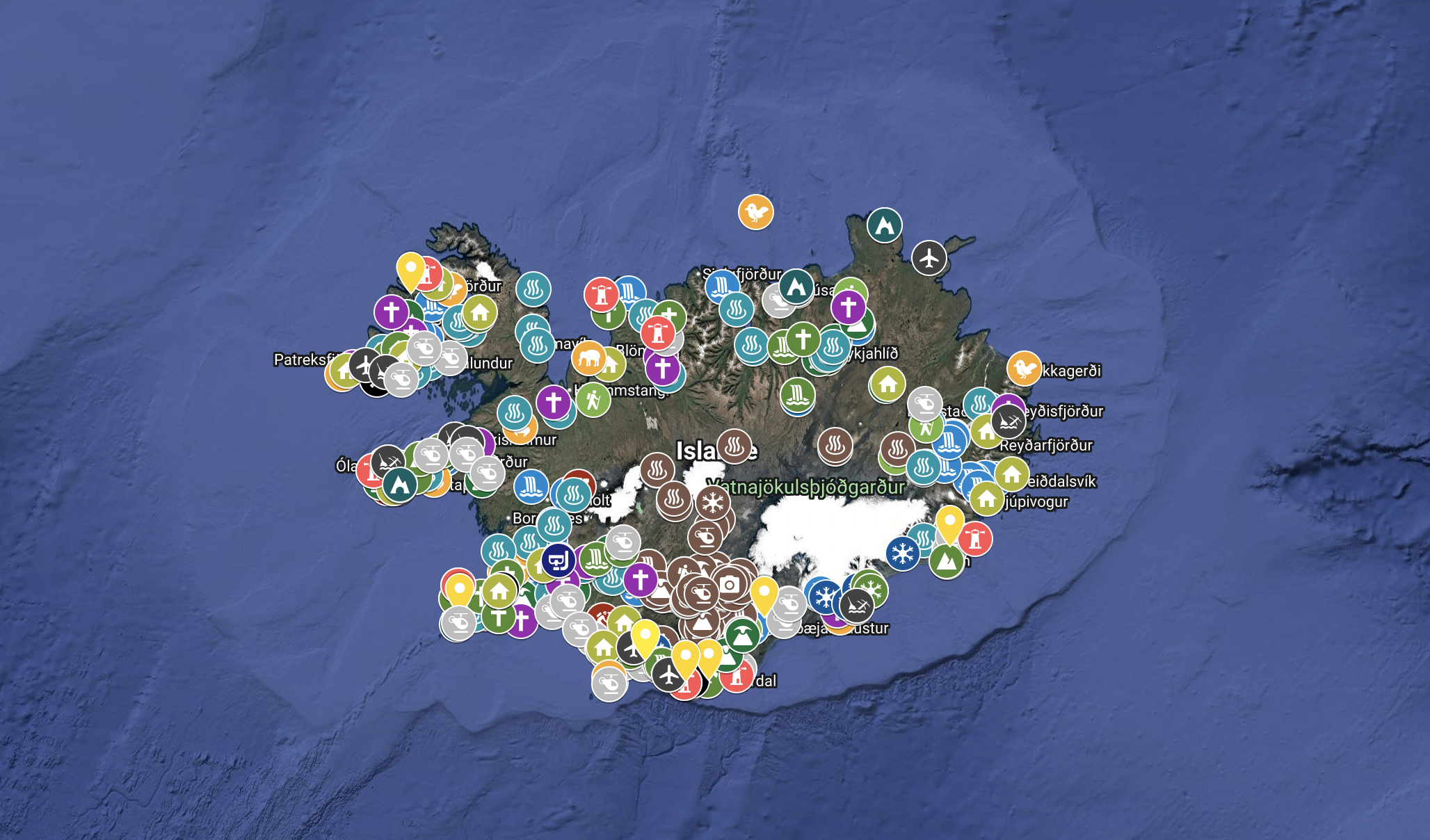
After five (soon to be six) trips to Iceland and hours spent cross-referencing information to build my itineraries, I eventually created the tool I wish I had from the start: an interactive map of Iceland with over 400 spots listed, each with my own photography and travel tips. In this article, I’ll walk you through how I use it to plan a road trip efficiently (because yes, I still use it today even though I’m starting to know the island pretty well), and how you can do the same.
Why an interactive map rather than a classic guide ?
The first time I went to Iceland, I prepared my trip the old-fashioned way: reading blogs, paper guides, manually created spot lists on Google Maps. It worked, but it was slow and fragmented. Practical info (parking, access, best light, season) was rarely in the same place as photography tips, and even more rarely accompanied by an honest, recent opinion from someone who actually went there.
An interactive map solves exactly that problem. Everything is in one place, visualised geographically, and filterable by type of location. At a glance, you can see what’s on your route, what’s worth a detour, and what can wait for a future trip. It saves a huge amount of time during planning, and it’s just as useful in the field when you’re looking for something to do within a 30km radius.
👉 My interactive Iceland map contains over 400 photo spots spread across the entire island, including :
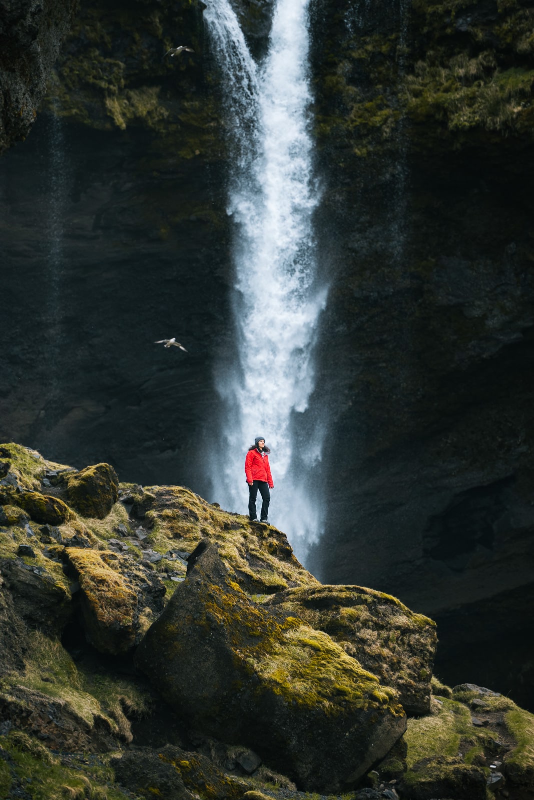
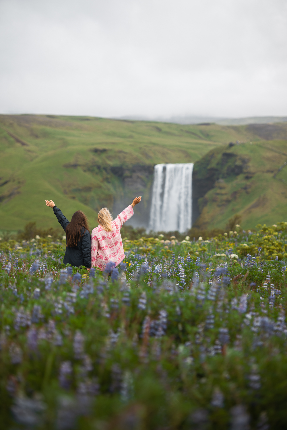
- 75 waterfalls, from the most famous to the most secret
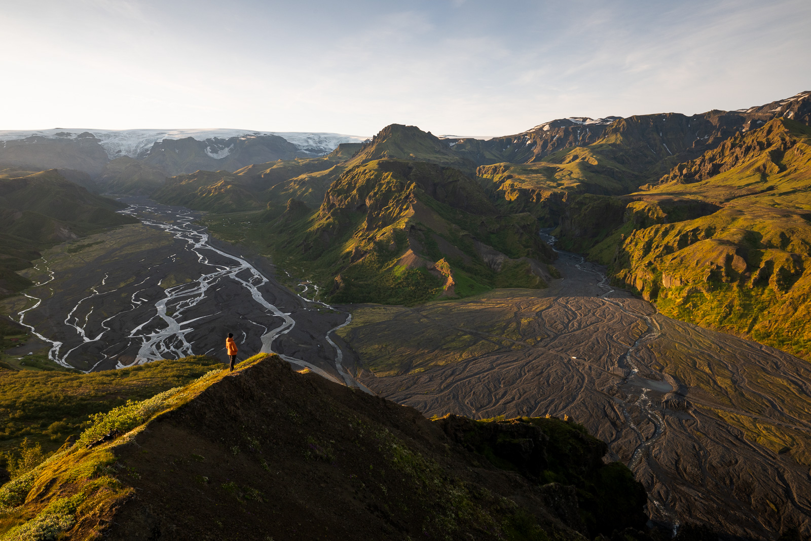
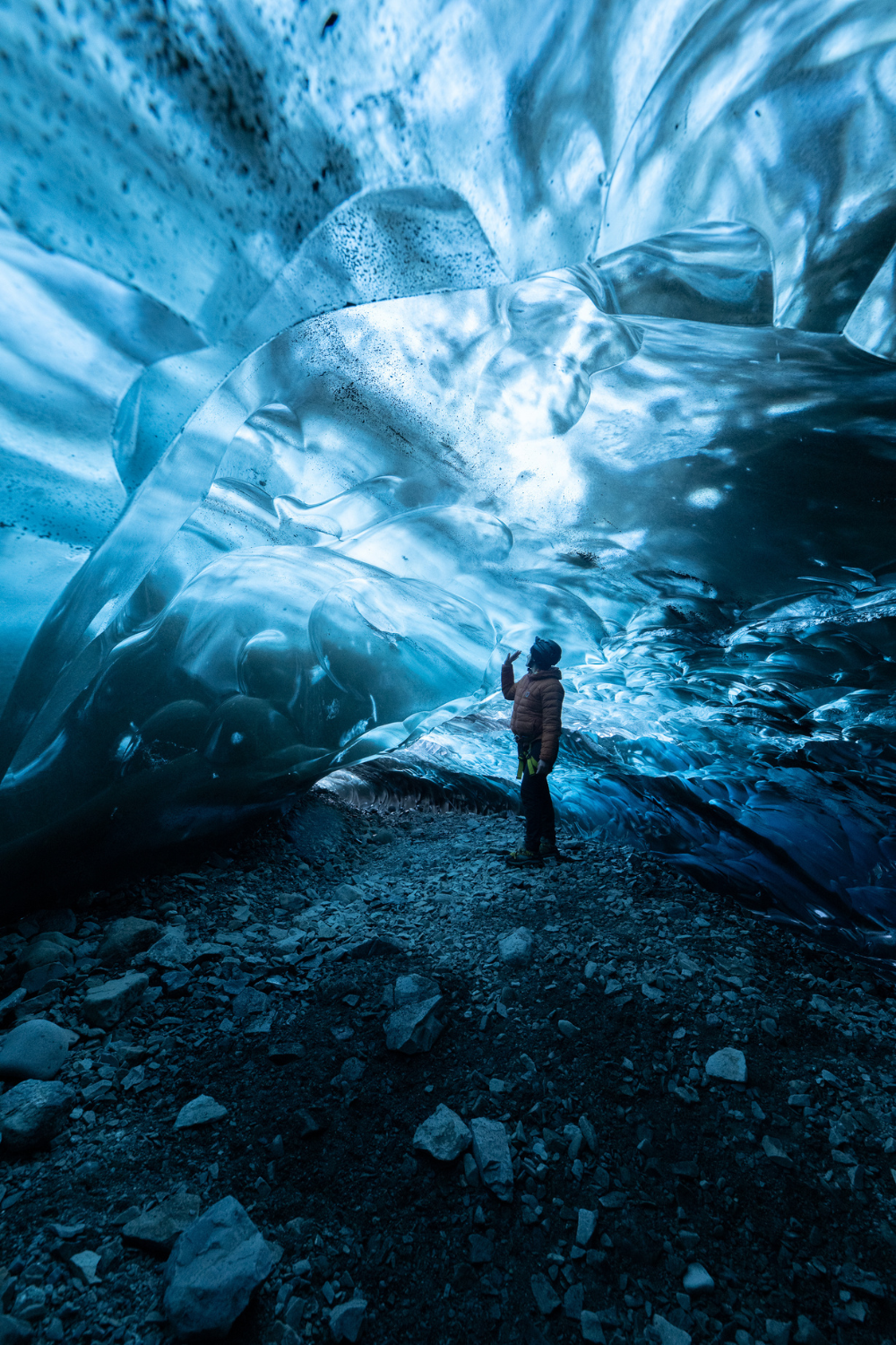
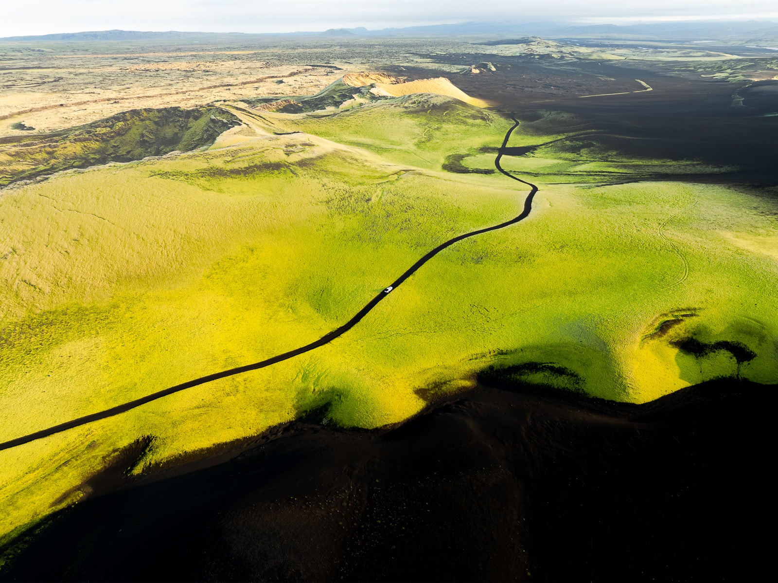
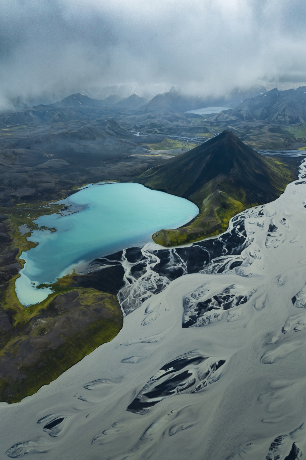
- 50 spots in the Highlands, because this area is a serious visual slap in the face
- 25 braided river spots, for lovers of cool geological formations
- 43 hot springs, for those who also want to relax
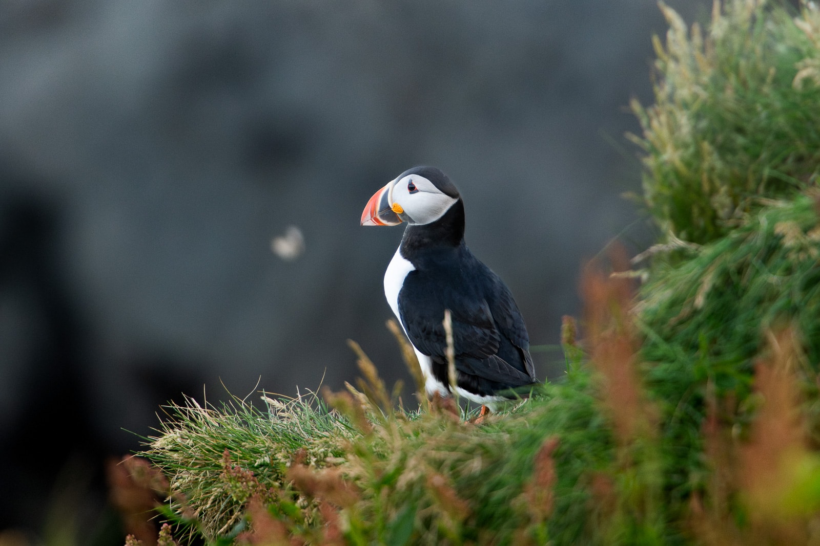
- 13 wildlife spots, for animal lovers
- Plus glacier and volcano viewpoints, hikes, off-the-beaten-path locations you won’t find in standard guides, basically everything that makes Iceland so beautiful. Discover my map 🇮🇸
What’s in the map ? Way more than a bunch of places
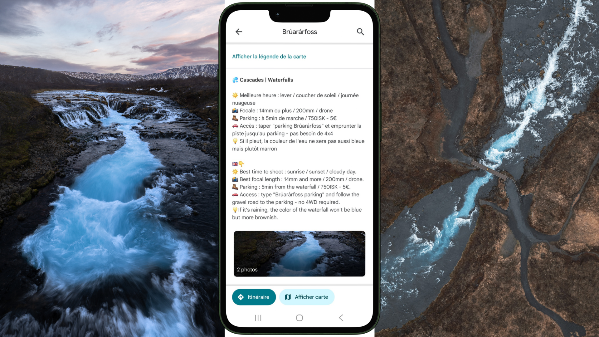
Every pin on the map comes with a detailed info sheet. It’s not just a point on a map with a name, it’s the equivalent of a mini-guide for each location, written from my own experience on the ground. For each spot, you’ll find :
Essential practical info
- How to get there (road, vehicle type required, road condition)
- Where to park and whether parking is paid
- Entry fee if applicable
- Best season to visit
- Mistakes to avoid or things to know (tides, tips for avoiding crowds, river crossings…)
- Links: to book your spot, trail maps, website for additional info
Photography info
- The best light (morning, evening, overcast, northern lights…)
- What gear to bring (wide angle, telephoto, tripod…)
- My composition ideas
It’s this combination of practical info and photography tips that makes the difference compared to a simple Google Maps list or a generic travel blog. I’m a landscape and nature photographer, so my recommendations are designed for people who want to come back with great photos, not just tick boxes.
How to use the map to build your itinerary
Start by choosing a region based on your trip length
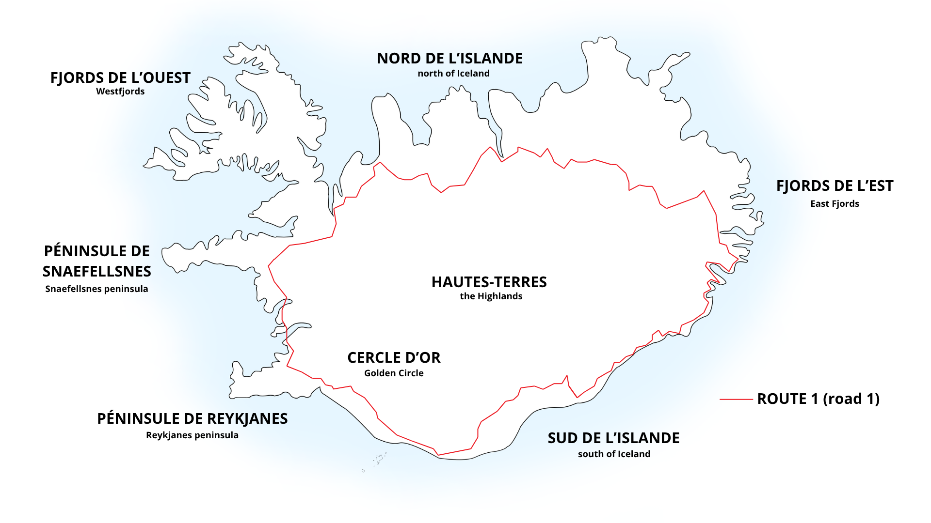
Iceland is big, really big, and most people tend to forget that when they look at Google Maps. The Ring Road alone is 1332km, and the Westfjords add another 400 km easily. The first thing to do is define which regions you’re going to cover based on how long you have, then filter the map accordingly.
👉 For a first trip of 7–10 days : focus on the south coast, the Golden Circle, and Snæfellsnes Peninsula. These are the areas with the biggest number of accessible spots and the easiest to chain together logistically. Also check out my practical guide to everything you need to know before going to Iceland for the basics.
👉 For a trip of 2 weeks or more, add the north (Mývatn, Akureyri, Húsavík), the East Fjords, and if you’re feeling adventurous, the Westfjords. In summer, the Highlands with a 4WD are also accessible and deserve several days on their own.
👉 For 3 weeks, you can do the full loop with detours. I’m working on an article about 3 weeks in Iceland this autumn that will give you a complete overview for that length of trip.
Identify your biggest priorities
Before filling your itinerary with spots, ask yourself : what are you actually coming to Iceland for ? Puffin photos ? Wild hot springs ? Glaciers ? Northern lights ? Waterfalls ? The answer will completely change how you organise your road trip and which season you can/want to go.
👉 If you’re coming for puffins, you’ll need to be there between May and August and plan detours to Látrabjarg, Borgarfjörður Eystri, or southern Iceland. I cover this in detail in my article on puffin photography (out this May).
👉 If you’re coming for northern lights, your travel dates change dramatically : you need dark nights, so October to March. Check out my article on how, when and where to photograph the northern lights in Iceland for everything you need to plan it.
👉 If you’re coming for classic landscapes, lava fields, glaciers and waterfalls, you’re in luck, those are accessible year-round. My articles on the 10 most beautiful waterfalls in Iceland and the 10 best hot springs (articles coming soon) will give you a good starting point, all you really need to do is choose how long your road trip will be!
Be honest about distances and travel times
This is the number one mistake travellers make in Iceland : underestimating travel times. Google Maps says 2 hours between two spots ? Calculate 2h30 minimum, sometimes 3 hours, because you’re going to stop for photos (“oh look at that, come on let’s pull over” is something you’ll say a lot), because the light is going to be perfect on a roadside waterfall, because you need to watch out for sheep trying to throw themselves under your wheels (it really happens), and also because some gravel roads have speed limits of 80km/h or even 60km/h.
In practice, I rarely plan more than 150-200km of driving per day including stops, and that’s already a lot. In the Westfjords where the roads are winding and there’s much more gravel track, I bring that down to 100-120km. It’s always better to do less and actually enjoy it than to rush from spot to spot. And you do need to sleep occasionally 😅
👉 Remember to check road.is the evening before or in the morning to stay updated on road conditions, some F-roads can close unexpectedly, which can completely reshuffle your day’s plans.
Group spots by coherent geographic zones
Hopefully this goes without saying, but group the places you want to visit by area… It’s the basic principle of an efficient itinerary, and my map makes it much easier : rather than making unnecessary back-and-forths, build thematic days around a limited geographic zone. For example :
- South coast day : Seljalandsfoss + Skógafoss + Reynisfjara + Dyrhólaey (with puffins in summer)
- Highlands day : Landmannalaugar (full day, early start, stay overnight)
- Westfjords day : Dynjandi + Látrabjarg (overnight stay on site is a mandatory given the distances)
My map lets you visualise these zones immediately and avoid duplicating driving time
Must-see spots types depending on your profile
For landscape photographers
The map is particularly detailed on photography spots, with lighting information, simply because I designed it as the tool I would have wanted for MYSELF. Photography is my top priorities when I travel, so I’ve packed in as much information as possible on how to make the most of landscape sessions. My personal must-sees for a first trip : the entire south coast up to Stokksnes, the Snæfellsnes Peninsula, and everything in the Highlands. I’m also working on a dedicated article on the best photography spots in southern Iceland, and another on the 10 most beautiful landscape photography locations in Iceland.
For wildlife lovers
You’re actually spoiled in Iceland : puffins, reindeer in the east, Arctic foxes at Hornstrandir, seals on the eastern and northern beaches, whales from Húsavík or Akureyri… Iceland is a wildlife paradise that doesn’t always get the credit it deserves! Every wildlife spot on the map comes with the best season and my photography tips.
For 4WD adventurers
The Highlands are strictly 4WD-only (a city car is a no, a proper 4WD is a yes), and that’s a good thing, because it protects these fragile spaces and ensures the landscapes stay relatively unspoiled. My map clearly indicates which spots require a 4WD, whether there are river crossings, their difficulty level, and what type of 4WD you need. My personal favorites : Landmannalaugar, Laki, Langisjór and Kerlingarfjöll.
And if you need to plan more, I’ve created a 110-pages Iceland Guide, with all the info you need to organize your trip :
- 5 ready-to-go itineraries, with budgets
- All the info on Iceland
- A detailed guide of seasons
- A detailed guide on how to drive in Iceland
- 3 exclusives photographe guides with my tips and secrets
- Tons of discounts to save hundreds of euros = the map and guide are more than reimbursed
And of course my interactive Iceland Photography Map is included, with +400 spots all around Iceland. By combining the Map and Guide, you get the most powerful tool to explore the country : easily visualize places, optimize your days and enjoy Iceland by being well prepared.
I hope Iceland puts as many stars in your eyes as it does in mine ! Have a safe trip 🇮🇸
Marie